Polyrrenia Chania is one of western Crete’s most undervisited ancient sites, and that is both its greatest flaw and its greatest asset. While tour buses queue for Knossos and Samaria Gorge fills with hikers by 7am, this hilltop city-state sits 50 kilometres west of Chania in near-quiet, with 2,500 years of layered history and one of the best views in all of Crete. Most visitors drive straight past it on the way to Balos or Falassarna. That is their loss.
Polyrrhenia was an ancient city in western Crete near Kissamos, occupied from the Iron Age to the Byzantine era, with a strategic hilltop location protected by Hellenistic and Roman fortifications. What makes it different from Crete’s other ancient sites is the sheer span of time compressed into one small hill. You are not looking at one civilisation’s ruins. You are looking at layer upon layer of human settlement, each period building on, over, or with the stones of the last. Some historians called the city “Sparta of Crete”, a nod to both its military character and its governance style. Come here if you want to understand western Crete’s ancient past without the crowds. Come with good shoes and water. There is nothing soft about the climb.
| Distance from Chania | 50km, about 60 minutes by car |
|---|---|
| Difficulty | Moderate (steep walk to acropolis) |
| Time needed | 2 to 3 hours including the village |
| Best season | April, May, June, September, October |
| Parking | Free in the village |
| Entrance fee | Free (open-air site) |
| Rental car needed? | Yes |
| Family friendly? | With older children |
The History of Polyrrenia: Three Thousand Years on One Hill
Ancient Polyrrinia was built in around 1100 BC by Achaean and Laconian colonists, although the area had been inhabited for far longer. The city’s political structure reflected those origins. Its political system is thought to have been similar to that of Sparta, with many organisational and administrative elements borrowed from the Laconians.
The etymology of the name Polyrrinia (Πολυρρήνια in Greek) reflects the main occupation of its inhabitants: it is derived from the words poly (many) and rinia (sheep), meaning “rich in lambs”. Despite that pastoral name, the symbol of the city stamped on its coins was a bull’s head, known as a bucranium. The reverse depicted Zeus Cretagenes, the “Cretan-born Zeus”.
Throughout its history, Polyrrinia developed close ties with several Greek city-states, including Sparta, Milos, Rhodes, and Thebes. During the Hellenistic period it was a powerful force and a rival to the nearby maritime city of Phalasarna. It opposed Knossos and Kydonia, but avoided participating in the resistance against the Romans, thus escaping the ensuing destruction. That calculated pragmatism served it well. Polyrrinia played an important part in Roman times, mainly due to its strategic decision to ally itself with the conquerors and assume a leading role in the area.
Polyrrinia became a powerful city with two harbours: one at Falassarna and one at Kissamos. Controlling both coasts meant controlling trade across the western tip of the island. The wealth showed. Like other important city-states of the same period, Polyrrenia minted its own coins, which are now exhibited in the Archaeological Museum of Kissamos.
According to tradition, King Agamemnon anchored near Polyrrinia, in the Nopigia area, to offer a sacrifice to the gods on his return from the victorious Trojan War. But before the sacrifice could be completed, he saw his ships being set alight by rebelling captives and had to leave in a hurry. Ever since, blood sacrifices left unfinished for some reason were known as “Cretan Sacrifices”. Whether you believe it or not, the story gives you a sense of how old the geography here is in the Greek imagination.
Polyrrenia sat at 418 metres above sea level, on a horseshoe-shaped hill that gave it command of the surrounding plains and the Gulf of Kissamos. It was not a city you took by surprise.
What to See at Polyrrenia Chania
The Fortification Walls
The city used to have imposing fortification walls, which are still visible in most of their extension. At the top of the acropolis, standing at about 400 metres above sea level, there is a well-preserved fortification of Byzantine origin. The site exhibits the remains of the ancient walls, from 10 to 18 feet (3.0 to 5.5 m) high. Walking alongside them gives you a real sense of the scale of what was built here, even if the city itself is largely gone.
In the Byzantine period, a castle was constructed on the acropolis site, incorporating elements of the earlier fortifications. The Byzantine castle walls reach a height of 3.5 metres in some places.
The Aqueduct and Water System
This is the detail that surprises most visitors. An aqueduct, one of the most visible remnants of the ancient city, supplied water to Polyrrhenia. A semicircular defensive tower, connected to the aqueduct by a pipeline, protected this critical infrastructure. Sections of the aqueduct’s galleries are still visible within the modern village.
From the Roman period survive the aqueducts with their overflow cisterns, and fountains set in places of worship. The water pipes run under the hill on which the city stands, and are combined with a network of stairs and underground exits which must also have formed part of the defences. In a hillside city with no natural springs, this system was everything.
Local tip: Walk slowly through the village before heading up to the acropolis. The aqueduct sections and the old houses built directly on ancient foundations are easy to miss if you head straight for the top. That layering of old and new, ancient stone and modern concrete, tells you as much about this place as anything on the acropolis itself.
The Church of the 99 Holy Fathers
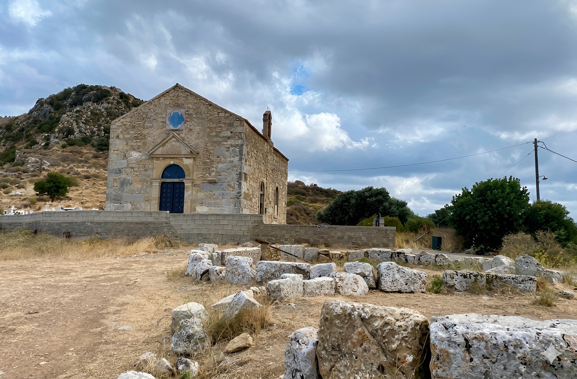
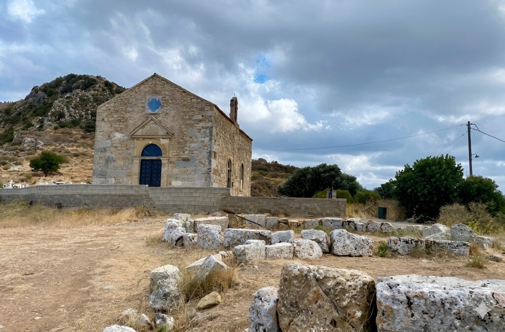
Near the top of the site stands a small church built in 1894. It seems unremarkable at first. Look closer. On the acropolis of Polyrrinia stood the Temple of Artemis Dictynna, where the small church of Agioi Pateres (the Holy Fathers) is today. It was built in 1894 using material from the ancient temple. Ancient inscriptions are set into the church walls, and part of the ancient altar has been used in the Christian one. Two thousand years of religious life compressed into a single small building. It is not a major monument. It is a remarkable detail.
The View from the Top
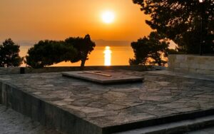
Visitors consistently praise Ancient Polyrrhenia for its archaeological ruins and phenomenal panoramic views of Kissamos Bay. On a clear day you can see across to the Gramvousa peninsula where Balos sits. You can trace the coastline all the way to Falassarna. The Lefka Ori, the White Mountains, fill the east. There are great 360-degree views from the top.
This is genuinely one of the better viewpoints in western Crete, and almost nobody is up here.
Local tip: The climb looks steep when you are standing at the bottom staring up at the acropolis. It is not as bad as it looks. If you walk along the track along the right-hand side of the church and just keep going, the track bends round the hill and takes you up to the top quite gradually. Allow about 20 to 25 minutes to reach the summit at a steady pace.
The Village Itself
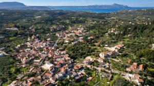
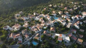
The village itself is a mixture of old ruins, rock houses, small churches and newer buildings. It is a functioning Cretan village, not a tourist exhibit. About 30 people live here year-round. In summer a few more return. In the village you can admire the Roman aqueduct, the old houses and the Venetian archways opposite the wonderfully restored community building.
There is an olive wood shop, a kafeneion with excellent cake, and a taverna at the top of the hill that is known for making fantastic Boureki, the local courgette and potato pie. If you have not eaten before driving up, this is worth stopping for.
Warning: There are limited facilities on the site. The small shop and taverna are not always open, and their hours are not posted anywhere. Do not rely on being able to buy food or water here. Bring your own.
Combining Polyrrenia with Sirikari Gorge
This is the combination that most visitors miss, and it is worth knowing about. You can start at Polyrrinia and walk the Sirikari Gorge as a circular route, going up the gorge and back down, or do it one way either from Polyrrinia or from the village of Sirikari. The gorge is home to many creatures, including lizards, goats, butterflies and Griffon vultures. It is usually not too busy, and once inside you really get a sense of being away from it all.
The Sirikari Gorge walk is easy, short and fairly flat, with some stones underfoot. It can be a bit difficult finding the start, which is why the route requires some research in advance. Gorge walking in spring, when there is water in the streambed, is a completely different experience from the dry summer months.
The Honest Notes
Most travel sites describe Polyrrenia in glowing terms and leave out the parts that matter to a visitor actually planning a trip. Here they are.
Warning: Some visitors note the limited information available on-site and the ruggedness of the access road and path. There is very little interpretive signage at Polyrrenia. You will walk past significant ruins and have no idea what you are looking at unless you have read up beforehand or bring a guidebook. This is not Knossos with reconstruction and display boards. It is a largely unmanaged open-air site. Manage your expectations accordingly, and do your reading before you go.
Warning: The biggest difficulty of the climb is the heat, as you are in full sun with no shade. In July and August, the exposed hillside becomes very hard going between 10am and 4pm. Arrive before 9am or after 5pm in high summer. In May, June, September and October, the temperature is manageable at any time of day.
The ancient city does not make a strong impression despite remains of its walls from 3 to 5.5 metres high. There is practically nothing left of the former power. That is an honest assessment. If you come expecting Delphi or Knossos, you will be underwhelmed. If you come expecting a quiet hillside with interesting ruins and extraordinary views, you will not be disappointed.
The road up is winding and narrow in sections. Drive cautiously on the way up as the road can be winding and wild in places. A standard rental car handles it fine. Just do not rush.
Before You Go
- Water: bring at least 1.5 litres per person. No reliable water sources on the site.
- Shoes: trail shoes or sturdy trainers minimum. The path is rocky and steep in sections.
- Sun: the acropolis climb is completely exposed. Hat and sunscreen are essential from May onwards.
- Food: bring a snack. The village taverna and cafe are not always open.
- Cash: if anything is open in the village, it will be cash only.
- Toilets: there is a tourist information point in the village with public toilets, but verify it is open before relying on it.
- Time: allow at least 2 hours. 3 hours if you want to explore properly without rushing.
Getting There
By Car
From Chania, first drive west to Kissamos (43 kilometres) and then another 7 kilometres to Polyrrinia. The whole trip is about 1 hour’s drive. From Kissamos, the road climbs into the hills south of town. It is signposted. Follow the signs for Polyrrinia. The road winds steadily upward through olive groves and small villages. Park in the village square or near the church at the entrance to the site. Parking is free.

By Bus
You can reach Polyrrenia with the local bus from Kissamos. However, bus services to the village are infrequent and the timetable changes seasonally. Check the KTEL Chania website before travelling. Getting to Kissamos from Chania by bus is straightforward and takes about an hour. The connection to Polyrrenia is the unreliable part.
By Taxi
You can get there by taxi from Kissamos. Agree on a price before you go, and discuss whether the driver will wait or return for you. There are no taxis in the village itself.
By Organised Tour
Guided tours from Chania rarely include Polyrrenia as a primary destination but some combine it with a Kissamos area day.
Practical Information
| Site type | Open-air archaeological site |
|---|---|
| Entrance fee | Free |
| Opening hours | Open at all times (no gates or fencing) |
| Nearest town | Kissamos, 7km |
| Distance from Chania | 50km |
| Drive time from Chania | Approximately 60 minutes |
| Parking | Free, in village |
| Toilets | Tourist information point in village (not always open) |
| Café/Food | Small village taverna and kafeneion (irregular hours) |
| Mobile signal | Variable on the hilltop |
| Best months | April to June, September to October |
| Accessibility | Not suitable for wheelchairs or mobility-impaired visitors |
Combine With
These four places work well in a single day trip from Chania or as part of a western Crete circuit based out of Kissamos.
Archaeological Museum of Kissamos. Before or after Polyrrenia, this is a must. The ground floor presents artifacts from different cities of Crete including Polyrrhenia, Ancient Phalassarna, and Drapanias. The upper floor is devoted to the city of Kissamos, with objects dating mostly from the Roman period. The biggest hall on the second floor features impressive mosaics. Two of them are particularly interesting and were part of important urban villas. The biggest depicts a magnificent allegory of Dionysus. Open daily from 8.30am to 3.30pm. Closed on Tuesdays. A small entrance fee applies.
Falassarna Beach. About 17 kilometres west of Kissamos, one of the best beaches in western Crete. Wide, with deep blue water and space even in high summer. Combine with the ruins of Ancient Falassarna nearby, which was Polyrrenia’s great rival city.
Balos Lagoon. About 20 kilometres northwest of Kissamos on the Gramvousa peninsula. Crete’s most photographed lagoon. You can drive to the car park and hike down, or take a boat from Kissamos harbour. Factor this in as a half-day addition rather than a quick stop.
Sirikari Gorge. As described above, this is accessible directly from the Polyrrenia area and adds a hiking dimension to the day. The gorge is home to lizards, goats, butterflies and Griffon vultures, and sees far fewer visitors than Samaria or Imbros.
Local tip: Drive back from Polyrrenia via the coast road through Kissamos and stop at one of the small fish tavernas on the waterfront for lunch before heading to Falassarna. The Kissamos waterfront is not on any tourist map. That is the point. Order whatever fish came in that morning. Sit for an hour. That combination, ancient ruins in the morning and fresh grilled fish looking at the bay, is exactly the kind of day that makes western Crete different from anywhere else on the island.